


Col de Feignes > Lac de Lispach > Longemer

Mariolebeno
User
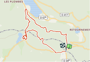

Length
10.6 km

Max alt
1091 m

Uphill gradient
558 m
Km-Effort
18 km

Min alt
747 m

Downhill gradient
556 m
Boucle
Yes
Creation date :
2022-08-19 08:28:30.62
Updated on :
2022-08-19 16:03:44.881
6h11
Difficulty : Difficult

FREE GPS app for hiking
 SityTrail
IGN / Geographical institutes
SityTrail Plus
The world is yours!
About
Trail Walking of 10.6 km to be discovered at Grand Est, Vosges, La Bresse. This trail is proposed by Mariolebeno.
Positioning
Country:
France
Region :
Grand Est
Department/Province :
Vosges
Municipality :
La Bresse
Location:
Unknown
Start:(Dec)
Start:(UTM)
349128 ; 5323567 (32U) N.
Comments